Posts

Starting the new year with a first activation

Image
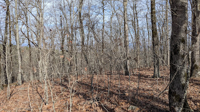
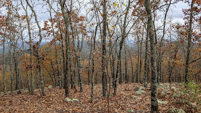
 I've started January with four summits activated in the first three weeks. If it's above 50 degrees and sunny, I'm trying to get out in the woods.  This is a good time of year for hiking in the Ouachita mountains.  The leaves are off the trees so you can see where you are going, the ticks are dormant and the poison ivy has died back for the winter. As a bonus, it's no longer deer season, so the woods aren't full of hunters. On Jan 18 I activated a summit that previously hadn't been activated.  It's the Crystal Mountains High Point, W51/CA-006. I'd had my eye on this summit for a couple years, as the topo maps show an old road headed back to base of the summit with what looked like a doable bushwhack to the top. I knew one other SOTA activator had his eye on it, so I wanted to beat him to it and claim first activator rights on this one.  The topo maps are correct, and the old road makes a pleasant hike to the base of the mountain.  The climb up is a typi

A good year for SOTA

Image
 I just realized I hadn't posted since last summer, so a quick summary of SOTA activity this fall. Yesterday I activated two easy summits here in AR to bring my total for the year to 68, with my point total now at 1204.  After making Moutain Goat last Spring, my goal was to get to 1200 by the end of the year and I made it.  Winter is a good time to do summits in Arkansas. The leaves are off the trees, the poison ivy and other vines are dormant and the ticks and chiggers are asleep for the winter. Over the winter I try to do the bushwhacks here in the state -- the summits where there isn't a trail to the top.  They are fun to do in the winter, but a nightmare in the summer. In the summer I stick to trails and old fire-tower roads.  So I'll try to keep up with next year's activations and do a better job of keeping the blog alive.  Operating position from West Mountain in Hot Springs National Park in November. With the leaves off the trees you almost have a view. During gu

Black Hills SOTA trip of 19 summits

Image
 I just returned from a month-long road trip west that included 17 summits in Black Hills and Wyoming.  That brings me to 1,154 points, 168 activations of 95 unique summits activated,  When you do that many summits in a short time, they start to run together.  So I'll run through my log and photo album with some notes on each summit.  I'm going to start with my second-to-the last summit, Red Mountain W7Y/SW-022.  This was the high point of my trip, hiking up to the summit at 10,500 feet.  That's the highest altitude I had hiked to, and cam almost three weeks into the trip.  Living at 500 feet, it's safe to say I'm not used to high altitude.  A few years ago the wife and I spent a day hiking in the Medicine Bow Mountains at 9,000 feet just a few days after leaving home.  That got me a mild case of altitude sickness, and reminder that you can't just to to high altitude and hike.  So this year I started by spending 10 days in the Black Hills of South Dakota, camped

Achieved a goal

Image
 On May 21 I achieved my long-term goal of reaching 1,000 points, making me a Mountain Goat in the world of Summits on the Air.  I was within 18 points so I went through different scenarios in my head to make my "goat day" special -- do some new summits, do some hard summits or do some easy ones.  After a week or going between the three options, I chose the easy path for Friday, May 21. The weather forecast was for a change of occasional showers, so I wasn't too worried as I left home at 8 a.m. headed for Rich Mountain, just north of Mena and about 2.5 hours west.  I figured I could work between the showers, if needed.   As I went west it got wetter and wetter, and by the time I reached Mena it was a torrential downpour.  Checking the radar, it looked like rain would pass by noon, so I headed up the road to the Talimena highway, which starts at Rich Mountain and winds its way into Oklahoma with multiple summits along the way.  Of course as I drove up the mountain out of M

A great camping/SOTA trip

Image
 Last weekend I took the wife and dog with me to my favorite campground -- Shady Lake Recreation Area -- and was able to squeeze in two of my favorite Arkansas summits -- Tall Peak W5A/CS-002 and Buckeye Mountain W5A/CS-003. Shady Lake is a beautiful, if somewhat rundown, campground at the base of the Cossatot Mountains in western Arkansas.  We were going on a weekend, but it was not at all crowded and we were able to score the best camp site that overlooks the lake.  This was great, as my wife was happy to sit and enjoy the view and nature while I hiked up Tall Peak on Friday afternoon.  Tall Peak is the home to an old fire tower that makes a great operating position.  It can be reached via a 3.5 mile trail from the campground or a 2.5 mile walk up a gated access road.  As I was short on time I hiked up the road which is a steady climb of about 600 feet.  You can see lake from the fire tower, and I even managed a contact on 2 meters with my wife, K9GAL at the campground from the top. 

13 summits in 7 days

Image
  I finished my epic road trip to the Blue Ridge Parkway with successful  activations of 13 summits in 7 days. This is by far my most ambitious SOTA trip to date. When you do that many summits in a few days, the details start to blur. So I'll try to document them here with the memories I have one week later.   Day 1 Wine Spring Bald -- W4C/WM-018 This was a summit I had driven by on multiple Mini rallies in North Carolina and made a good stop on my second day of driving to the BRP. It is nearly a drive up, with a half-mile hike up a road to get to the top. This is right next to the Appalachian Trail which goes over the Wayah Bald a mile away. While hiking down the road I could hear people talking on the AT, which parallels the road. Photo is view from Wayah Bald.   Day 2 Waterrock Knob -- W4C/WM-010 After a cold night at a National Forest campground at 5,000 feet I got on the BRP and did this popular spot on the parkway. There is a well-maintained trail to the top w

Sunday afternoon

Image
Last Sunday was a perfect Spring day here in Arkansas, so I headed out to the woods. I went to one of my new favorites, Slattington Benchmark W5A/CS-001, in the Caddo Mountains about 90 miles west of Little Rock. This is a typical Arkansas Summit. You get there by following a Forest Service road up a pass over a range in the Ouachitas. At the pass an old Jeep trail heads up the ridge to an abandoned fire lookout tower site. The Jeep road has devolved into a brushy hiking trail, but I could see that a few other souls had made the hike this spring. It is about a 1 mile hike with 700 foot elevation gain. The first 1/2 mile is all uphill, but once you hit the ridge you are rewarded with great views. At the end of the trail is a clearing, the concrete footings of the fire tower and great views. As a bonus on the drive home I cut through the back roads and the Dogwoods were in full bloom. Another great day in the woods. Looking west from Slatington Benchmark Dogwoods in bloo

Big trip coming

Image
I have a trip planned the week of April 36 to the Blue Ridge Mountains. I hope to activate 12 summits in 4 days along the Blue Ridge Parkway. I will post reports as I make progress. Day 1 and 2 Day 3 Day 3